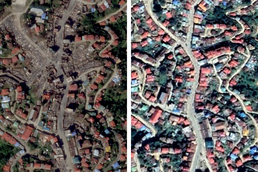
The fiery destruction by Myanmar soldiers of sections of a town of 10,000 people in western Myanmar’s restive Chin state late last month can clearly be seen in satellite photos of the area released at the weekend.
In the second known round of burning by troops loyal to the junta that overthrew Myanmar’s elected government on February 1, witnesses said regime soldiers entered Thantlang township on October 29, began looting the property of residents, and then set fires that burned more than 200 homes, as well as some churches.
The torching of at least 200 homes in Thantlang, came a month after junta troops had set fire to the town, burning 18 homes and a hotel, and sending residents fleeing across the border to India’s Mizoram state to escape a military offensive, Chin sources said at the time.
The burnings were condemned by New York-based Human Rights Watch as “a crime against humanity,” while the State Department said the international community must “hold the Burmese military accountable and take action to prevent gross violations and abuses of human rights.”
The junta denied being behind the Thantlang attacks and demanded its accusers present evidence. But anyone returning to the burned-out township to investigate the fires risks arrest or retaliation by troops who are occupying the area.
Copyright © 1998-2020, RFA. Used with the permission of Radio Free Asia, 2025 M St. NW, Suite 300, Washington DC 20036. https://www.rfa.org.
Source: Licas Philippines
0 Comments